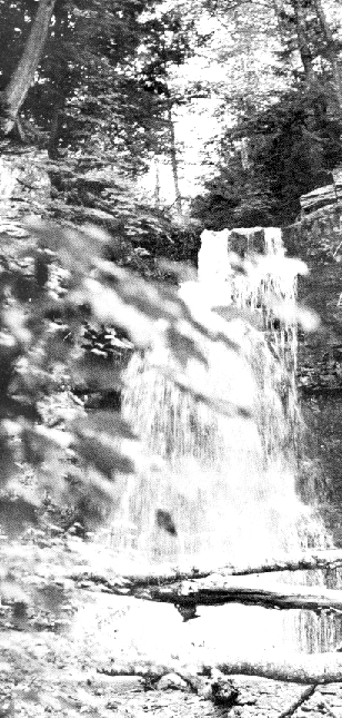
 I've been looking through summer camp yearbooks that were made and printed in the early to mid-70s. (For a few years we diligently took photos of every village and sometime in the winter put together and mailed to every camper and staff member an honest-to-goodness yearbook. They're rare now, although a few of us have them, and they are also on display in the Historical Room of the Ad Office at camp.) In the yearbook for 1973 the photos are all of the villages and candids of kids and staff doing activities. But one is a nice black-and-white shot of High Falls. The reproduction here doesn't do it justice.
 Most of us have hiked to High Falls many times, and probably almost all of us have camped there, at one of the two overnight sites ("High Falls Lower" or "High Falls Upper"). But few of us have hiked along the brook above the falls. I recommend it with great enthusiasm. In fact, if you keep hiking along the brook you will find yourself turning to the northeast and climbing near the western ridge of Doubletop Mountain. Yes, High Falls Brook to the west and Pigeon Brook to the east are the two streams bounding the Frost Valley side of Doubletop. Many FV'ers know that by hiking up Pigeon you can get close to the Doubletop's peaks. Few know that the same is true of High Falls Brook. So try it. It's a difficult climb - goes up steep angles toward the end. And then, depending on the time of year, the brook ends sooner or later at its muddy and swampy and brambly beginning, and then you must (as always on Doubletop) use a compass to go the rest of the way. There are several beautiful little waterfalls above High Falls, and while in aesthetic terms HF Brook is a C+ to Piegon's A+, it is worth doing if only because so few do it.

