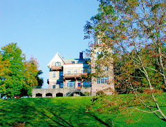
At left: Brian Butler and Bill Baker.
This morning at breakfast (brunch actually--it's the slow, late middle Sunday of a session--I learned from Brian Butler that he's lost pretty much all of his photos and old camp materials. He went to some reunion of camp friends, left it all at his host's house, and the host seems to have disappeared from the FV radar. But one thing Brian did have he whipped out of his pocket: viola!, a large green handkerchief imprinted with the map of Frost Valley. Here is my photo of the hanky map below. Click on the image for a larger view. Study the map and see if you can guess the year it was made. My explanation of the rationale for dating it is below the photo in small font. Don't go there until you've finished making your own educated guess.

Well, first you begin by noting that there's just one building labelled "dining hall." Prior to '82 we had two dining halls - "the Boys' Dining Hall" or "Thomas Lodge" and "the Girls' Dining Hall" or "Conover English Hall." During the period before the completion of the new dining hall, on the spot of the old boys' DH, we ate all together in one dining hall--formerly the girls' DH. So the dining hall on the hanky must be the newly built one, and it was finished in 1986. So we know the that the hanky is '86 or after. Next we notice that the superlodges - Hyde & Watson (built around where cabin 12 is on this map) and Quirk (built where 15 and 16 are) - are not there yet, and that was the mid-90s. Nor do we see Scott and Neversink Lodges, built between cabins 1-6 and Sequoia, and that was early '90s. But Hussey Lodge is here and the cabins that once formed Forest, 6-10, have been turned into A and B (staff cabins), with 7, 8 and 9 moved up the hill to join the old Outpost cabins 11-15. So this is after Hussey and before the other so-called "cabin lodges." I'm going to guess 1988 or '89. The main office is still called the "Ad Office" here (my preferred designation for it). Archery is still happening in the apple orchard behind Hayden. The bike shop is still at the end of the Arts & Crafts building. Notice too the location of what was for many years the Girls' Chapel, a smaller and not as well located version of the old Wawayanda Chapel (which is still in use). Veterans of girls' camp can correct me but I believe the location of the Hird Chapel is wrong on this map. I believe it was located below 36-40 and above the Deus property. Will someone tell me if that's right?